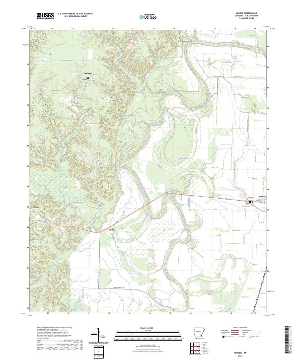
2024 Map of Snyder
USGS Topo · Published 2024About this map
Bayou Bartholomew winds through this section of Ashley County, defining a landscape of complex hydrology and agricultural patterns. The eastern portion of the map is dominated by the community of Montrose, which sits at the intersection of HWY 278 and W Market ST. This area contains important genealogical markers, including the Montrose African American Cem and Montrose Cem Number 1, reflecting the long-standing community history in this Delta region.
Find a feature on this map
50 named features on this map. Tap any name to fly to it.
Don’t see what you’re looking for? This feature index may not catch every label — zoom into the map to look around manually.
Map Details
Editions of this 2024 Snyder Map
This is the sole edition of this map. No revisions or reprints were ever made.
Other maps of this area

1935 · Mist
USGS Topo · 1:62,500

1935 · Wilmot
USGS Topo · 1:62,500

1936 · Eudora
USGS Topo · 1:62,500

1936 · Lake Village
USGS Topo · 1:62,500

1953 · Greenwood
USGS Topo · 1:250,000

1955 · Lake Village
USGS Topo · 1:62,500

1956 · Greenwood
USGS Topo · 1:250,000

1957 · Eudora
USGS Topo · 1:62,500

1960 · Snyder
USGS Topo · 1:24,000

1960 · Mist
USGS Topo · 1:62,500