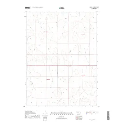
2017 Map of Snyder Lake
USGS Topo · Published 2017About this map
Snyder Ranch Airport serves as a lone modern landmark within this expanse of the Nebraska Sandhills in McPherson County. The landscape is defined by the shifting topography of dunes and interdunal basins, where transportation is limited to a few specific corridors. Key paths such as Tin Camp Rd, Melvin Dr, and Soddy Rd navigate the township boundaries of t19n r34w, t19n r33w, t18n r34w, and t18n r33w. This 2017 survey reflects the enduring character of a ranching environment where large tracts of land remain sparsely developed, emphasizing the reliance on specific ranch-access points and remote dirt roads to traverse the rolling terrain.
Find a feature on this map
8 named features on this map. Tap any name to fly to it.
Don’t see what you’re looking for? This feature index may not catch every label — zoom into the map to look around manually.
Map Details
Editions of this 2017 Snyder Lake Map
This is the sole edition of this map. No revisions or reprints were ever made.
Other maps of this area

1898 · Paxton
USGS Topo · 1:125,000

1901 · Paxton
USGS Topo · 1:125,000

1949 · Flats
USGS Topo · 1:62,500

1949 · Wright Valley
USGS Topo · 1:62,500

1950 · Flats
USGS Topo · 1:62,500

1951 · Wright Valley
USGS Topo · 1:62,500

1954 · North Platte
USGS Topo · 1:250,000

1956 · North Platte
USGS Topo · 1:250,000

1957 · North Platte
USGS Topo · 1:250,000

1967 · North Platte
USGS Topo · 1:250,000