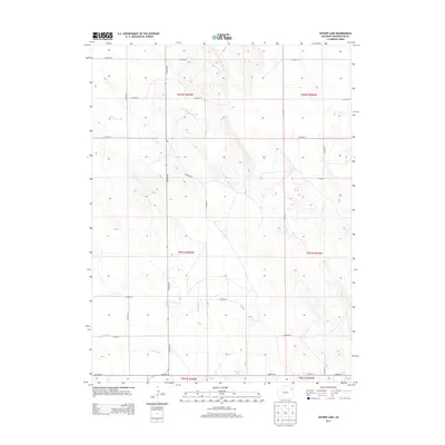
2013 Map of Snyder Lake
USGS Topo · Published 2013About this map
Snyder Lake serves as a focal point in this high plains landscape of Washington County, where the terrain is defined by a grid of rural routes and intermittent drainage systems. The survey reveals a structured agricultural layout, with roads like Co Road RR and Co Road 32 segmenting the land into precise townships. Ephemeral waterways including Brunker Creek and Hell Creek meander through the sections, indicating the natural drainage patterns that have influenced land use in this part of Colorado. A notable navigational landmark for local history researchers is Cemetery Rd, which suggests the presence of early community sites within this sparsely populated ranching and farming region.
Find a feature on this map
22 named features on this map. Tap any name to fly to it.
Don’t see what you’re looking for? This feature index may not catch every label — zoom into the map to look around manually.
Map Details
Editions of this 2013 Snyder Lake Map
This is the sole edition of this map. No revisions or reprints were ever made.
Other maps of this area

1954 · Limon
USGS Topo · 1:250,000

1954 · Sterling
USGS Topo · 1:250,000

1957 · Limon
USGS Topo · 1:250,000

1958 · Limon
USGS Topo · 1:250,000

1958 · Sterling
USGS Topo · 1:250,000

1972 · Otis
USGS Topo · 1:24,000

1972 · Hyde
USGS Topo · 1:24,000

1972 · Snyder Lake
USGS Topo · 1:24,000

1972 · Otis SE
USGS Topo · 1:24,000

1973 · Platner
USGS Topo · 1:24,000