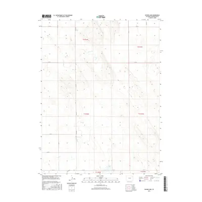
2016 Map of Snyder Lake
USGS Topo · Published 2016About this map
Snyder Lake serves as a focal point in this high plains landscape of Washington County, where the terrain is defined by wide drainages and an orderly section-line road network. The ephemeral flow of Brunker Cr and Hell Cr carves subtle relief into the prairie, indicating the seasonal water patterns essential to this ranching and agricultural region. Long stretches of gravel routes like Co Road Rr and Co Rd 30 divide the land into distinct townships, including t1n r50w and t1n r49w. This survey illustrates the persistent geometry of the Public Land Survey System in eastern Colorado, showing how property boundaries and local infrastructure remain tethered to the original township and range grid long after the initial settlement era.
Find a feature on this map
18 named features on this map. Tap any name to fly to it.
Don’t see what you’re looking for? This feature index may not catch every label — zoom into the map to look around manually.
Map Details
Editions of this 2016 Snyder Lake Map
This is the sole edition of this map. No revisions or reprints were ever made.
Other maps of this area

1954 · Limon
USGS Topo · 1:250,000

1954 · Sterling
USGS Topo · 1:250,000

1957 · Limon
USGS Topo · 1:250,000

1958 · Limon
USGS Topo · 1:250,000

1958 · Sterling
USGS Topo · 1:250,000

1972 · Otis
USGS Topo · 1:24,000

1972 · Hyde
USGS Topo · 1:24,000

1972 · Snyder Lake
USGS Topo · 1:24,000

1972 · Otis SE
USGS Topo · 1:24,000

1973 · Platner
USGS Topo · 1:24,000