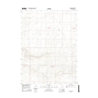
2015 Map of Soap Holes
USGS Topo · Published 2015About this map
Continental Divide National Scenic Trail- Wyoming Portion winds through this high-elevation landscape in Fremont County, marking a modern corridor along the backbone of the American West. The terrain is characterized by dramatic elevation shifts and seasonal watercourses, with Bull Canyon and the eponymous Soap Holes topographic features defining the local geography. This 2015 survey captures the intersection of established township boundaries including t29n r94w and t28n r94w. The drainage patterns of Happy Spring Cr and Haypress Cr illustrate the hydraulic connectivity of this arid region. For researchers, the map provides a precise layout of the national scenic trail as it existed in the early 21st century, set against the traditional Public Land Survey System grid.
Find a feature on this map
9 named features on this map. Tap any name to fly to it.
Don’t see what you’re looking for? This feature index may not catch every label — zoom into the map to look around manually.
Map Details
Editions of this 2015 Soap Holes Map
This is the sole edition of this map. No revisions or reprints were ever made.
Other maps of this area

1951 · Soap Holes
USGS Topo · 1:24,000

1951 · Graham Ranch
USGS Topo · 1:24,000

1951 · Crooks Mountain
USGS Topo · 1:24,000

1951 · Myers Ranch
USGS Topo · 1:24,000

1953 · Sweetwater Station
USGS Topo · 1:24,000

1953 · Happy Spring
USGS Topo · 1:24,000

1955 · Lander
USGS Topo · 1:250,000

1955 · Casper
USGS Topo · 1:250,000

1958 · Casper
USGS Topo · 1:250,000

1958 · Lander
USGS Topo · 1:250,000