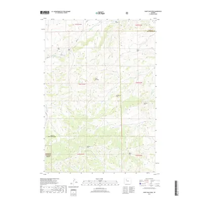
2017 Map of Soapy Dale Peak
USGS Topo · Published 2017About this map
Soapy Dale Peak and Leon Baird Peak dominate this high-elevation landscape along the border of Park and Hot Springs counties. This area is defined by sharp topographic reliefs and named draws that drain toward the Bighorn Basin, including Renner Draw, Bill Dickie Draw, and Sanford Draw. The northwestern corner features the striking formations of Red Cliff and Wall Rock, while the northern edge is marked by the descent into Red Canyon. A significant portion of the southwestern quadrant falls within the Shoshone National Forest, preserving a wilderness character where drainages like Enos Cr and Roach Cr originate. The presence of Mossy Pond near Gooseberry Cr provides a rare water source in this high country. This map records the modern state of these public lands, showing the network of service roads such as Sawmill Rd and 4CP Rd that provide access for land management and recreational use.
Find a feature on this map
31 named features on this map. Tap any name to fly to it.
Don’t see what you’re looking for? This feature index may not catch every label — zoom into the map to look around manually.
Map Details
Editions of this 2017 Soapy Dale Peak Map
This is the sole edition of this map. No revisions or reprints were ever made.
Other maps of this area

1904 · Kirwin
USGS Topo · 1:125,000

1906 · Kirwin
USGS Topo · 1:125,000

1911 · Meeteetse
USGS Topo · 1:62,500

1913 · Meeteetse
USGS Topo · 1:62,500

1955 · Cody
USGS Topo · 1:250,000

1955 · Thermopolis
USGS Topo · 1:250,000

1956 · Milk Creek
USGS Topo · 1:24,000

1956 · Twentyone Creek
USGS Topo · 1:24,000

1956 · Soapy Dale Peak
USGS Topo · 1:24,000

1956 · Adam Weiss Peak
USGS Topo · 1:24,000