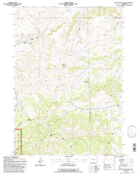
1991 Map of Soapy Dale Peak
USGS Topo · Published 1997About this map
Soapy Dale Peak and Leon Baird Peak dominate this high-desert landscape along the boundary of Park and Hot Springs counties. The terrain is defined by a series of deep drainages and draws, including Gooseberry Creek, Mormon Creek, and Enos Creek, which carve through prominent geologic features such as Red Cliff and Wall Rock. Human activity in this remote region is sparse, centered on isolated agricultural outposts like Dollar Ranch and Buckles Ranch, connected by a network of 4WD tracks and private roads.
Find a feature on this map
28 named features on this map. Tap any name to fly to it.
Don’t see what you’re looking for? This feature index may not catch every label — zoom into the map to look around manually.
Map Details
Editions of this 1991 Soapy Dale Peak Map
This is the sole edition of this map. No revisions or reprints were ever made.
Other maps of this area

1904 · Kirwin
USGS Topo · 1:125,000

1906 · Kirwin
USGS Topo · 1:125,000

1911 · Meeteetse
USGS Topo · 1:62,500

1913 · Meeteetse
USGS Topo · 1:62,500

1955 · Cody
USGS Topo · 1:250,000

1955 · Thermopolis
USGS Topo · 1:250,000

1956 · Milk Creek
USGS Topo · 1:24,000

1956 · Twentyone Creek
USGS Topo · 1:24,000

1956 · Soapy Dale Peak
USGS Topo · 1:24,000

1956 · Adam Weiss Peak
USGS Topo · 1:24,000