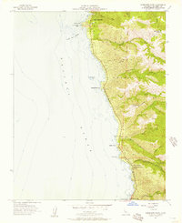
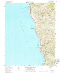
1956 Map of Soberanes Point
USGS Topo · Published 1957About this map
Notleys Landing sits on a high terrace overlooking the Pacific, a focal point of human activity in this coastal landscape during the mid-1950s. The map illustrates the transition from the residential enclave of Carmel Highlands in the north to the sprawling Palo Corona Ranch further inland. Deep drainages like Palo Colorado Canyon and Garrapata Creek cut through the steep coastal hills, while the offshore waters are designated as The California Sea Otter Game Refuge.
Find a feature on this map
34 named features on this map. Tap any name to fly to it.
Don’t see what you’re looking for? This feature index may not catch every label — zoom into the map to look around manually.
Map Details
Editions of this 1956 Soberanes Point Map
5 editions found
Other maps of this area

1913 · Monterey
USGS Topo · 1:62,500

1918 · Point Sur
USGS Topo · 1:62,500

1925 · Point Sur
USGS Topo · 1:62,500

1941 · Monterey
USGS Topo · 1:62,500

1947 · Point Sur
USGS Topo · 1:62,500

1947 · Seaside
USGS Topo · 1:24,000

1947 · Monterey
USGS Topo · 1:62,500

1947 · Monterey
USGS Topo · 1:24,000

1948 · Santa Cruz
USGS Topo · 1:250,000
1948 · Seaside
USGS Topo · 1:24,000