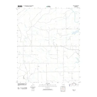
2010 Map of Sobol
USGS Topo · Published 2010About this map
Ringold Cemetery and Sobol Cemetery anchor a landscape defined by the winding tributaries that feed into the Little River at the edge of the Kiamichi foothills. This 2010 U.S. Geological Survey representation of McCurtain County reflects a rural topography where navigation follows a grid of county roads and named paths like Caney Mountain Trl. The presence of the Sobol Lookout Tower near Bull Mountain indicates the importance of timber and fire watch in this heavily forested region. Further south, the map documents the Rufe Cemetery and remnants of industrial transit such as Tram Rd, likely a legacy of earlier logging operations. The intricate drainage network of North Turkey Creek, Salt Creek, and Rock Creek illustrates the complex watershed that shapes the local terrain and settlement patterns.
Find a feature on this map
35 named features on this map. Tap any name to fly to it.
Don’t see what you’re looking for? This feature index may not catch every label — zoom into the map to look around manually.
Map Details
Editions of this 2010 Sobol Map
This is the sole edition of this map. No revisions or reprints were ever made.
Other maps of this area

1901 · Alikchi
USGS Topo · 1:125,000

1950 · Mcalester
USGS Topo · 1:250,000

1962 · McAlester
USGS Topo · 1:250,000

1962 · Wright City
USGS Topo · 1:24,000

1962 · Sobol
USGS Topo · 1:24,000

1962 · Caney Mountain
USGS Topo · 1:24,000

1962 · Alikchi
USGS Topo · 1:24,000

1962 · Signal Mountain
USGS Topo · 1:24,000
1962 · Swink
USGS Topo · 1:24,000

1965 · McAlester
USGS Topo · 1:250,000