
1962 Map of Signal Mountain
USGS Topo · Published 1964About this map
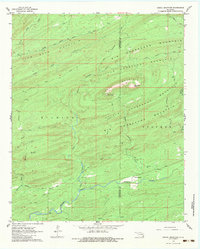
Signal Mountain and the surrounding ridgelines of the Kiamichi range dominate this early 1960s survey of the Oklahoma highlands. The landscape is defined by a series of prominent peaks and valleys, including John Noah Mountain, Kiamichi Mountain, and the curved formations of Big Horseshoe Mountain and Little Horseshoe Mountain. Human impact in this period is largely limited to isolated outposts and early wilderness routes, most notably the Signal Mountain Lookout Tower and the Brannon Ranch located along the southern reaches of Terrapin Creek.
Find a feature on this map
26 named features on this map. Tap any name to fly to it.
Don’t see what you’re looking for? This feature index may not catch every label — zoom into the map to look around manually.
Map Details
Editions of this 1962 Signal Mountain Map
3 editions found
Other maps of this area

1901 · Alikchi
USGS Topo · 1:125,000

1902 · Lukfata
USGS Topo · 1:125,000

1950 · Mcalester
USGS Topo · 1:250,000

1959 · Golden
USGS Topo · 1:62,500

1960 · Bethel
USGS Topo · 1:62,500

1962 · McAlester
USGS Topo · 1:250,000

1962 · Sobol
USGS Topo · 1:24,000

1962 · Caney Mountain
USGS Topo · 1:24,000

1962 · Alikchi
USGS Topo · 1:24,000

1965 · McAlester
USGS Topo · 1:250,000