
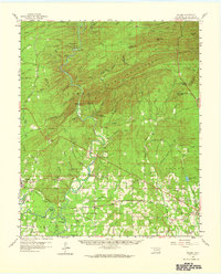
1959 Map of Golden
USGS Topo · Published 1960About this map
The Glover River cuts a deep path through the southeastern Oklahoma landscape, flowing between Sulphur Mountain and Bear Mountain before reaching the southern lowlands. This mid-century survey captures a region defined by its timber and river geography, where the Industrial Railroad serves Wright City and the surrounding woodlands. The map documents numerous community landmarks, including the Glover Sch near the settlement of Glover, and the Lukfata Ch and Lukfata Cem to the southeast. To the south, the Little River forms complex oxbows and bends like Thompson Bend and Shuler Bend, surrounded by swampy features such as Sunk Lake and Pine Lake Slough. These water patterns reveal the shifting nature of the river system before modern development further altered the drainage of McCurtain County.
Find a feature on this map
83 named features on this map. Tap any name to fly to it.
Don’t see what you’re looking for? This feature index may not catch every label — zoom into the map to look around manually.
Map Details
Editions of this 1959 Golden Map
2 editions found
Other maps of this area

1901 · Alikchi
USGS Topo · 1:125,000

1902 · Lukfata
USGS Topo · 1:125,000

1950 · Mcalester
USGS Topo · 1:250,000

1950 · Idabel
USGS Topo · 1:24,000

1950 · Shults
USGS Topo · 1:24,000

1951 · Idabel
USGS Topo · 1:24,000

1951 · Garvin
USGS Topo · 1:24,000

1951 · Shults
USGS Topo · 1:24,000

1951 · Millerton
USGS Topo · 1:24,000

1953 · Texarkana
USGS Topo · 1:250,000