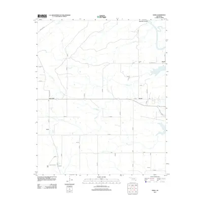
2012 Map of Sobol
USGS Topo · Published 2012About this map
Pine Knot Crossing marks a northern point of interest along the Little River, where the waterway meets Terrapin Creek in this part of southeastern Oklahoma. The landscape is defined by its drainage systems, with Rain Creek, Salt Creek, and Rock Creek carving through the terrain toward the river. Small settlements and residential hubs like Ringold, Burwell, and Sobol are connected by a grid of rural roads and trails, including the Caney Creek Trail and Caney Mountain Trail. For genealogists, the map identifies several local burial sites such as Ringold Cemetery, Sobol Cemetery, and Rufe Cemetery. The high ground of Bull Mountain in the southwest provides a vantage point for the Sobol Lookout Tower, reflecting a rural area focused on land management and timber resources.
Find a feature on this map
54 named features on this map. Tap any name to fly to it.
Don’t see what you’re looking for? This feature index may not catch every label — zoom into the map to look around manually.
Map Details
Editions of this 2012 Sobol Map
This is the sole edition of this map. No revisions or reprints were ever made.
Other maps of this area

1901 · Alikchi
USGS Topo · 1:125,000

1950 · Mcalester
USGS Topo · 1:250,000

1962 · McAlester
USGS Topo · 1:250,000

1962 · Wright City
USGS Topo · 1:24,000

1962 · Sobol
USGS Topo · 1:24,000

1962 · Caney Mountain
USGS Topo · 1:24,000

1962 · Alikchi
USGS Topo · 1:24,000

1962 · Signal Mountain
USGS Topo · 1:24,000
1962 · Swink
USGS Topo · 1:24,000

1965 · McAlester
USGS Topo · 1:250,000