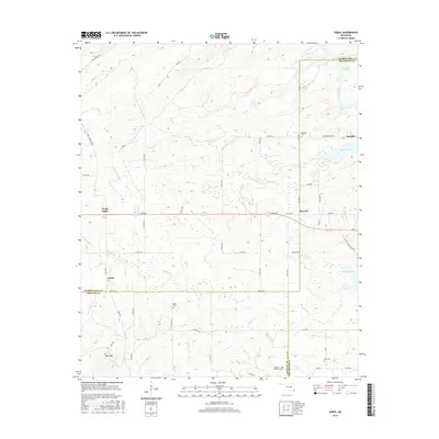
2016 Map of Sobol
USGS Topo · Published 2016About this map
Sobol and its neighbor North Sobol sit at the intersection of several local routes in this pocket of Southeast Oklahoma, where the landscape is defined by the drainages of Turkey Cr and Rock Cr. The map reveals a deeply-rooted community evidenced by several family and institutional burial grounds, most notably the Choctaw Academy Cem near the southern boundary. This area, spanning the borders of Choctaw, McCurtain, and Pushmataha counties, shows a transition from the elevated terrain of Bull Mtn in the southwest toward the aquatic expanse of Pine Creek Lake and the Little River to the east.
Find a feature on this map
57 named features on this map. Tap any name to fly to it.
Don’t see what you’re looking for? This feature index may not catch every label — zoom into the map to look around manually.
Map Details
Editions of this 2016 Sobol Map
This is the sole edition of this map. No revisions or reprints were ever made.
Other maps of this area

1901 · Alikchi
USGS Topo · 1:125,000

1950 · Mcalester
USGS Topo · 1:250,000

1962 · McAlester
USGS Topo · 1:250,000

1962 · Wright City
USGS Topo · 1:24,000

1962 · Sobol
USGS Topo · 1:24,000

1962 · Caney Mountain
USGS Topo · 1:24,000

1962 · Alikchi
USGS Topo · 1:24,000

1962 · Signal Mountain
USGS Topo · 1:24,000
1962 · Swink
USGS Topo · 1:24,000

1965 · McAlester
USGS Topo · 1:250,000