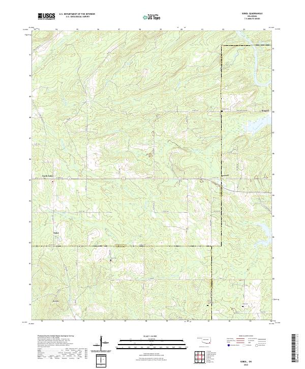
2022 Map of Sobol
USGS Topo · Published 2022About this map
The tri-county junction of Pushmataha, McCurtain, and Choctaw counties defines this Oklahoma landscape, where the Little River and Turkey Creek drain a terrain of ridges and valleys. Small rural communities like Sobol, North Sobol, Burwell, and Ringold are connected by a network of section line roads and specialized routes such as Tram Rd, which hints at the area's timber or industrial history. Local genealogy is well-documented through several burial sites, including the Choctaw Academy Church Cem and the Rufe Cem. The northern portion of the map is dominated by higher elevations, featuring Bull Mtn and recreational paths like the Caney Creek Trl, while the southern reaches level out into the drainage basins of Rock Creek and Bull Cr.
Find a feature on this map
67 named features on this map. Tap any name to fly to it.
Don’t see what you’re looking for? This feature index may not catch every label — zoom into the map to look around manually.
Map Details
Editions of this 2022 Sobol Map
This is the sole edition of this map. No revisions or reprints were ever made.
Other maps of this area

1901 · Alikchi
USGS Topo · 1:125,000

1950 · Mcalester
USGS Topo · 1:250,000

1962 · McAlester
USGS Topo · 1:250,000

1962 · Wright City
USGS Topo · 1:24,000

1962 · Sobol
USGS Topo · 1:24,000

1962 · Caney Mountain
USGS Topo · 1:24,000

1962 · Alikchi
USGS Topo · 1:24,000

1962 · Signal Mountain
USGS Topo · 1:24,000
1962 · Swink
USGS Topo · 1:24,000

1965 · McAlester
USGS Topo · 1:250,000