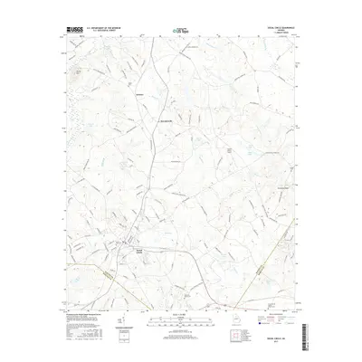
2017 Map of Social Circle
USGS Topo · Published 2017About this map
Social Circle serves as the primary hub of this 2017 survey, situated at the intersection of local routes and the CSX Transportation line. The landscape is characterized by a dense network of watercourses, including the Alcovy River and Little River, which carve through the terrain alongside prominent landmarks like Alcovy Mtn. The map preserves the locations of several smaller settlements such as Whitney and Herndonville, providing a clear view of the rural-to-suburban transition in this portion of Walton County. Genealogical interest is particularly high due to the identification of several family and community burial grounds, including the Union Springs Baptist Church Cem, Hollis and Sigman Cem, and Moore Cem. From the small airfield at Sleepy Hollow Airport to the rapids of Browning Shoals, the map documents a community defined by its rolling topography and historical road network.
Find a feature on this map
135 named features on this map. Tap any name to fly to it.
Don’t see what you’re looking for? This feature index may not catch every label — zoom into the map to look around manually.
Map Details
Editions of this 2017 Social Circle Map
This is the sole edition of this map. No revisions or reprints were ever made.
Other maps of this area

1896 · Monroe
USGS Topo · 1:125,000

1953 · Athens
USGS Topo · 1:250,000

1958 · Athens
USGS Topo · 1:250,000

1959 · Athens
USGS Topo · 1:250,000

1963 · Athens
USGS Topo · 1:250,000

1964 · Between
USGS Topo · 1:24,000

1964 · High Shoals
USGS Topo · 1:24,000

1964 · Monroe
USGS Topo · 1:24,000

1964 · Covington
USGS Topo · 1:24,000
1964 · Jersey
USGS Topo · 1:24,000