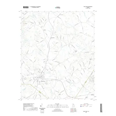
2020 Map of Social Circle
USGS Topo · Published 2020About this map
Social Circle serves as the primary hub of this landscape, where the CSX rail line intersects the town center and historical neighborhood grids. The geography is defined by the headwaters of the Alcovy River and its numerous tributaries, including Means Cr and Strouds Cr, which drain the undulating terrain of Walton, Morgan, and Newton counties. Rising significantly above the surrounding plains, Alcovy Mtn stands as a prominent landmark in the northwest corner, while the Browning Shoals mark a point of interest on the eastern boundary near Hard Labor Cr.
Find a feature on this map
137 named features on this map. Tap any name to fly to it.
Don’t see what you’re looking for? This feature index may not catch every label — zoom into the map to look around manually.
Map Details
Editions of this 2020 Social Circle Map
This is the sole edition of this map. No revisions or reprints were ever made.
Other maps of this area

1896 · Monroe
USGS Topo · 1:125,000

1953 · Athens
USGS Topo · 1:250,000

1958 · Athens
USGS Topo · 1:250,000

1959 · Athens
USGS Topo · 1:250,000

1963 · Athens
USGS Topo · 1:250,000

1964 · Between
USGS Topo · 1:24,000

1964 · High Shoals
USGS Topo · 1:24,000

1964 · Monroe
USGS Topo · 1:24,000

1964 · Covington
USGS Topo · 1:24,000
1964 · Jersey
USGS Topo · 1:24,000