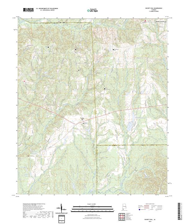
2024 Map of Society Hill
USGS Topo · Published 2024About this map
Society Hill serves as a central hub for this rural stretch where Macon, Lee, and Russell counties converge. The landscape is defined by its small family cemeteries and country churches, reflecting a long-standing pattern of dispersed agricultural settlement. Locations like the Society Hill Cem and Whatley Cem near Whatley Cross Road provide essential data points for genealogists tracing local families. The drainage network is particularly dense here, with Opintlocco Creek and Uchee Creek carving through the terrain, while man-made water features such as Engineering Farm Pond and Talbert Lake indicate more recent land management. The presence of Kelly Pond Number Two and Groce Lake further illustrates the intersection of natural hydrology and rural development in this corner of Alabama.
Find a feature on this map
75 named features on this map. Tap any name to fly to it.
Don’t see what you’re looking for? This feature index may not catch every label — zoom into the map to look around manually.
Map Details
Editions of this 2024 Society Hill Map
This is the sole edition of this map. No revisions or reprints were ever made.
Other maps of this area

1906 · Dadeville
USGS Topo · 1:125,000

1907 · Opelika
USGS Topo · 1:125,000

1909 · Opelika
USGS Topo · 1:125,000

1955 · Phenix City
USGS Topo · 1:250,000

1957 · Phenix City
USGS Topo · 1:250,000

1958 · Phenix City
USGS Topo · 1:250,000

1971 · Parkers Crossroads
USGS Topo · 1:24,000

1971 · Little Texas
USGS Topo · 1:24,000

1971 · Loachapoka
USGS Topo · 1:24,000
1971 · Marvyn
USGS Topo · 1:24,000