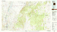
1979 Map of Socorro
USGS Topo · Published 1979About this map
Socorro and the surrounding Rio Grande valley dominate the southwestern corner of this 1970s land management study, showcasing a corridor of established settlements and irrigation. The Atchison Topeka and Santa Fe railroad tracks parallel Interstate 25, passing through riverside communities like Lemitar, Polvadera, and San Acacia. These small villages represent a long history of agricultural settlement along the river, contrasting sharply with the expansive protected lands to the east and north.
Find a feature on this map
136 named features on this map. Tap any name to fly to it.
Don’t see what you’re looking for? This feature index may not catch every label — zoom into the map to look around manually.
Map Details
Editions of this 1979 Socorro Map
2 editions found
Other maps of this area

1906 · Socorro
USGS Topo · 1:62,500

1916 · La Joya
USGS Topo · 1:125,000

1917 · Estancia
USGS Topo · 1:125,000

1917 · Cerro Verde
USGS Topo · 1:125,000

1918 · Oscura Peak
USGS Topo · 1:125,000

1948 · Carthage
USGS Topo · 1:62,500

1948 · Broken Back Crater
USGS Topo · 1:62,500

1948 · Bingham
USGS Topo · 1:62,500

1948 · San Antonio
USGS Topo · 1:62,500

1950 · Little Black Peak
USGS Topo · 1:62,500