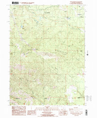
1988 Map of Soda Mountain
USGS Topo · Published 1988About this map
Soda Mountain dominates the high-altitude terrain of the southern Siskiyou Mountains in this 1980s-era survey, where the border between Oregon and California cuts across a landscape defined by seasonal creeks and steep ridges. The Pacific Crest National Scenic Trail winds through the central portion of the sheet, passing near Hobart Bluff and Hobart Pk. Notable human activity is clustered near the northern edge of the map at Lincoln, which includes Lincoln Station and a nearby radio tower. Historically significant sites such as Schoolhouse Ranch and the Tubb Springs State Wayside reflect the area's legacy of early ranching and travel stops along the mountain passes. The presence of the Pinghurst State Airport at Mountain View underscores the remote necessity of air access in this high-country region, while drainage patterns like Keene Creek and Oregon Gulch dictate the local topography leading toward Agate Flat.
Find a feature on this map
43 named features on this map. Tap any name to fly to it.
Don’t see what you’re looking for? This feature index may not catch every label — zoom into the map to look around manually.
Map Details
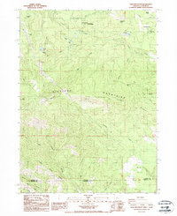
Editions of this 1988 Soda Mountain Map
2 editions found
Other maps of this area

1886 · Shasta
USGS Topo · 1:250,000

1891 · Ashland
USGS Topo · 1:250,000

1893 · Ashland
USGS Topo · 1:250,000

1894 · Shasta
USGS Topo · 1:250,000

1897 · Ashland
USGS Topo · 1:250,000

1922 · Shasta Valley Sheet No 16
USGS Topo · 1:24,000

1922 · Shasta Valley Sheet No 15
USGS Topo · 1:24,000

1932 · Yreka
USGS Topo · 1:96,000

1934 · Macdoel
USGS Topo · 1:96,000

1938 · Medford
USGS Topo · 1:125,000