
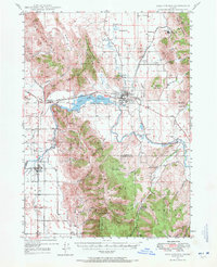
1948 Map of Soda Springs
USGS Topo · Published 1965About this map
The Oregon Trail passes through the heart of this landscape, running alongside the Soda Reservoir and through the historic community of Soda Springs. This mid-century survey reveals a region defined by industrial extraction and high-altitude ranching, where the Conda Mine sits at the foot of the Aspen Range. Settlement patterns follow the life-giving waters of the Bear River and the Oregon Short Line Railroad, connecting the town of Alexander to the agricultural hub at Grace. To the south, the Caribou National Forest covers the high terrain around Soda Peak, while local history is marked by features like the Wagonbox Grave and several abandoned mineral sites, including the Idaho Sulphur Mine (Aband). Local civic life is anchored by the Grace Cem, Eightmile Sch, and the Eightmile Ranger Sta.
Find a feature on this map
61 named features on this map. Tap any name to fly to it.
Don’t see what you’re looking for? This feature index may not catch every label — zoom into the map to look around manually.
Map Details
Editions of this 1948 Soda Springs Map
2 editions found
Other maps of this area

1909 · Montpelier
USGS Topo · 1:125,000

1911 · Montpelier
USGS Topo · 1:125,000

1911 · Slug Creek
USGS Topo · 1:62,500

1914 · Henry
USGS Topo · 1:48,000

1915 · Preston
USGS Topo · 1:96,000

1915 · Lanes Creek
USGS Topo · 1:62,500

1916 · Henry
USGS Topo · 1:62,500

1917 · Portneuf
USGS Topo · 1:62,500

1918 · Preston
USGS Topo · 1:125,000

1948 · Bancroft
USGS Topo · 1:62,500