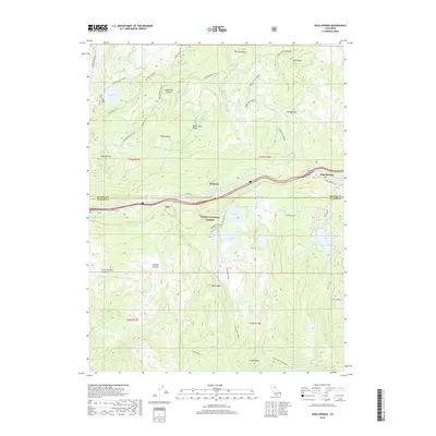
2018 Map of Soda Springs
USGS Topo · Published 2018About this map
Kingvale and the community of Troy anchor the central corridor of this Sierra Nevada landscape, where the S Yuba River and South Yuba River guide the paths of modern transport alongside the older Hampshire Rocks Rd. The map illustrates a high-elevation environment dominated by the Tahoe National Forest, characterized by dozens of alpine water bodies including the twin Upper Lola Montez Lake and Lower Lola Montez Lake. The terrain is defined by dramatic elevations like Magonigal Summit and Devils Peak, with the northern edge featuring the distinctive Glacier Lakes Basin. For the local historian, the map preserves the names of early infrastructure and landmarks such as Huntley Mill Lake and the Heath Falls Overlook above the N Fork American River.
Find a feature on this map
62 named features on this map. Tap any name to fly to it.
Don’t see what you’re looking for? This feature index may not catch every label — zoom into the map to look around manually.
Map Details
Editions of this 2018 Soda Springs Map
This is the sole edition of this map. No revisions or reprints were ever made.
Other maps of this area

1891 · Colfax
USGS Topo · 1:125,000

1891 · Truckee
USGS Topo · 1:125,000

1892 · Colfax
USGS Topo · 1:125,000

1893 · Truckee
USGS Topo · 1:125,000

1894 · Colfax
USGS Topo · 1:125,000

1895 · Truckee
USGS Topo · 1:125,000

1898 · Colfax
USGS Topo · 1:125,000

1900 · Colfax
USGS Topo · 1:125,000

1902 · Colfax
USGS Topo · 1:125,000

1932 · Truckee
USGS Topo · 1:96,000