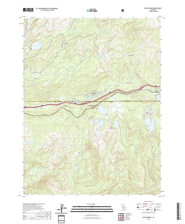
2021 Map of Soda Springs
USGS Topo · Published 2021About this map
Tahoe National Forest dominates this high-elevation landscape in the Sierra Nevada, characterized by an intricate network of alpine lakes and dramatic granite peaks. The settlement of Soda Springs serves as a primary point of interest at the eastern edge, while the transit corridor following Donner Pass Rd connects smaller clusters such as Kingvale and Troy. The terrain is marked by significant topographical landmarks like Devils Peak and Magonigal Summit, with numerous trails including the Hole in the Ground Trl and Sterling Trl weaving through the backcountry.
Find a feature on this map
69 named features on this map. Tap any name to fly to it.
Don’t see what you’re looking for? This feature index may not catch every label — zoom into the map to look around manually.
Map Details
Editions of this 2021 Soda Springs Map
This is the sole edition of this map. No revisions or reprints were ever made.
Other maps of this area

1891 · Colfax
USGS Topo · 1:125,000

1891 · Truckee
USGS Topo · 1:125,000

1892 · Colfax
USGS Topo · 1:125,000

1893 · Truckee
USGS Topo · 1:125,000

1894 · Colfax
USGS Topo · 1:125,000

1895 · Truckee
USGS Topo · 1:125,000

1898 · Colfax
USGS Topo · 1:125,000

1900 · Colfax
USGS Topo · 1:125,000

1902 · Colfax
USGS Topo · 1:125,000

1932 · Truckee
USGS Topo · 1:96,000