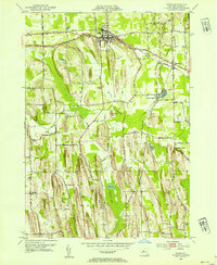
1952 Map of Sodus
USGS Topo · Published 1954About this map
The glacial topography of Wayne County is prominently displayed here, defined by the distinct drumlin formations that rise between Sodus and the southern reaches of Arcadia. These elongated ridges, such as Governor Hill and Brantling Hill, dictate the winding paths of rural roads like Middle Road and Zurich Road. In this post-war period, the region's agricultural character is balanced by the industrial presence of the New York Central and Pennsylvania railroads, which intersect at Wallington. Local life is anchored by a network of rural schoolhouses, including School No 5 and School No 16, and small settlements like Sodus Center and Zurich. The drainage of the landscape follows the low ground between drumlins, forming Salmon Creek and Maxwell Creek, while localized wetlands like Mets Pond and Wildlife Marsh Pond populate the depressions.
Find a feature on this map
79 named features on this map. Tap any name to fly to it.
Don’t see what you’re looking for? This feature index may not catch every label — zoom into the map to look around manually.
Map Details
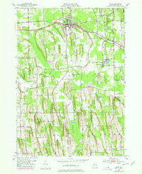
Editions of this 1952 Sodus Map
2 editions found
Other maps of this area

1899 · Palmyra
USGS Topo · 1:62,500

1902 · Sodus Bay
USGS Topo · 1:62,500

1902 · Pultneyville
USGS Topo · 1:62,500

1902 · Clyde
USGS Topo · 1:62,500

1902 · Palmyra
USGS Topo · 1:62,500

1942 · Pultneyville
USGS Topo · 1:31,680

1943 · Lyons
USGS Topo · 1:31,680

1943 · Williamson
USGS Topo · 1:31,680

1943 · Sodus Point
USGS Topo · 1:31,680

1943 · Sodus
USGS Topo · 1:31,680