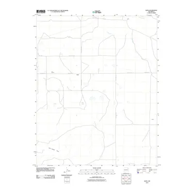
2010 Map of Sofia
USGS Topo · Published 2010About this map
Sofia serves as the central hub of this northeastern New Mexico landscape, situated in an area where the open plains begin to yield to the volcanic profiles of the Don Carlos Hills to the southwest. The mapping reveals a sparse ranching and agricultural network defined by long, straight county roads and scattered seasonal watercourses. Local history is anchored at the Sofia Cemetery, while the northern boundary of the quadrangle follows the path of Carrizo Creek. Small, named locales such as Jones and Ashley reflect the localized nature of settlement in this part of Union County. The drainage patterns of Cedar Creek and its various tributaries illustrate the hydrology of the High Plains, where water is a critical but often ephemeral resource shaping the placement of homesteads and transportation routes.
Find a feature on this map
14 named features on this map. Tap any name to fly to it.
Don’t see what you’re looking for? This feature index may not catch every label — zoom into the map to look around manually.
Map Details
Editions of this 2010 Sofia Map
This is the sole edition of this map. No revisions or reprints were ever made.
Other maps of this area

1954 · Dalhart
USGS Topo · 1:250,000

1958 · Dalhart
USGS Topo · 1:250,000

1962 · Dalhart
USGS Topo · 1:250,000

1972 · Malpie Mountain
USGS Topo · 1:24,000

1972 · Cow Mountain
USGS Topo · 1:24,000

1973 · Gladstone NW
USGS Topo · 1:24,000

1973 · Grenville SW
USGS Topo · 1:24,000

1973 · Tripod Mountain
USGS Topo · 1:24,000

1973 · Sofia
USGS Topo · 1:24,000

1973 · Romero Spring
USGS Topo · 1:24,000