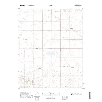
2023 Map of Sofia
USGS Topo · Published 2023About this map
Sofia sits as a quiet focal point in the high plains of Union County, defined by a sparse network of section-line roads and wide-open rangeland. The settlement is anchored by the Sofia Cem, a vital site for genealogical research in this part of northeastern New Mexico. To the south, the topography shifts with the rising forms of the Don Carlos Hills, providing the most significant relief in an otherwise expansive landscape. The area's intermittent drainage is marked by the winding paths of Cedar Creek and Carrizo Creek, which carve subtle paths through the terrain. A grid of local routes like Belcheff Rd and Sofia Rd provide the primary infrastructure for the ranching operations and family holdings that have shaped this region's history into the twenty-first century.
Find a feature on this map
17 named features on this map. Tap any name to fly to it.
Don’t see what you’re looking for? This feature index may not catch every label — zoom into the map to look around manually.
Map Details
Editions of this 2023 Sofia Map
This is the sole edition of this map. No revisions or reprints were ever made.
Other maps of this area

1954 · Dalhart
USGS Topo · 1:250,000

1958 · Dalhart
USGS Topo · 1:250,000

1962 · Dalhart
USGS Topo · 1:250,000

1972 · Malpie Mountain
USGS Topo · 1:24,000

1972 · Cow Mountain
USGS Topo · 1:24,000

1973 · Gladstone NW
USGS Topo · 1:24,000

1973 · Grenville SW
USGS Topo · 1:24,000

1973 · Tripod Mountain
USGS Topo · 1:24,000

1973 · Sofia
USGS Topo · 1:24,000

1973 · Romero Spring
USGS Topo · 1:24,000