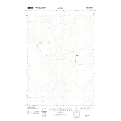
2013 Map of Solana
USGS Topo · Published 2013About this map
Solana sits at the heart of this Aitkin County landscape, where a network of forest roads and truck trails defines the local infrastructure. The terrain is dominated by the winding course of the Snake River, which snakes from the northwest corner toward the southeast, joined by the smaller Chelsey Brook at the map's edge. This 2013 topographic survey captures the area's timber-related character, notably marked by the White Pine Lookout Tower situated atop a local rise. The transportation web is sparse but specific, with corridors like the White Pine Forest Rd, Giese Truck Trl, and Herubin Truck Trl providing access through the wetland-adjacent topography. For researchers, these named tracks and family-named routes such as Knudson Rd and Stulg Rd offer precise points for mapping local property boundaries and historic wood-lot access in this rural Minnesota township.
Find a feature on this map
12 named features on this map. Tap any name to fly to it.
Don’t see what you’re looking for? This feature index may not catch every label — zoom into the map to look around manually.
Map Details
Editions of this 2013 Solana Map
This is the sole edition of this map. No revisions or reprints were ever made.
Other maps of this area

1953 · Duluth
USGS Topo · 1:250,000

1958 · Duluth
USGS Topo · 1:250,000

1968 · Kroschel NW
USGS Topo · 1:24,000

1968 · Giese
USGS Topo · 1:24,000

1968 · Mc Grath
USGS Topo · 1:24,000

1969 · Solana
USGS Topo · 1:24,000

1969 · Arthyde
USGS Topo · 1:24,000

1969 · Thor NE
USGS Topo · 1:24,000

1969 · Thor SE
USGS Topo · 1:24,000

1969 · Split Rock Lake
USGS Topo · 1:24,000