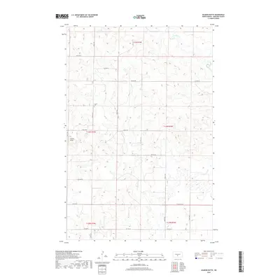
2018 Map of Solberg Butte
USGS Topo · Published 2018About this map
Swedish Cem serves as a quiet landmark in this rural landscape of northern Burleigh County, situated near the intersection of 119th St NE and 156th Ave NE. The terrain is defined by the high point of Solberg Butte in the western section, while the drainage of W Br Apple Cr winds through the northeast corner. This 2018 survey illustrates the persistent section-line road grid, including 106th St NE and 123rd Ave NE, which has organized the agricultural settlement of these townships since the original land surveys. The spatial arrangement of these coordinates and the presence of the cemetery provide essential points of reference for tracing local family landholdings in the region.
Find a feature on this map
22 named features on this map. Tap any name to fly to it.
Don’t see what you’re looking for? This feature index may not catch every label — zoom into the map to look around manually.
Map Details
Editions of this 2018 Solberg Butte Map
This is the sole edition of this map. No revisions or reprints were ever made.
Other maps of this area

1907 · Bismarck
USGS Topo · 1:125,000

1951 · Menoken SW
USGS Topo · 1:24,000

1951 · Menoken
USGS Topo · 1:62,500

1951 · McKenzie
USGS Topo · 1:62,500

1954 · Bismarck
USGS Topo · 1:250,000

1954 · McClusky
USGS Topo · 1:250,000

1958 · Bismarck
USGS Topo · 1:250,000

1958 · McClusky
USGS Topo · 1:250,000

1962 · Menoken SW
USGS Topo · 1:24,000

1975 · McKenzie
USGS Topo · 1:24,000