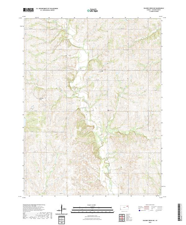
2022 Map of Soldier Creek NW
USGS Topo · Published 2022About this map
Soldier Cr and its tributaries, including Little Cross Cr, carve a network of drainage through this agricultural landscape in northern Jackson County. The terrain is defined by the winding course of these waterways and a sharp landform known as Oak Mills Bend. Settlement patterns follow the traditional township and range grid, with sections bounded by rural routes such as 246th Rd and 214th Rd. For those researching local family history, the map identifies small, rural burial grounds including Olive Hill Cem and Boan Cem, which remain as quiet landmarks of the community's early development. The absence of large urban centers highlights the area's enduring reliance on the land and the waterways that sustain it.
Find a feature on this map
22 named features on this map. Tap any name to fly to it.
Don’t see what you’re looking for? This feature index may not catch every label — zoom into the map to look around manually.
Map Details
Editions of this 2022 Soldier Creek NW Map
This is the sole edition of this map. No revisions or reprints were ever made.
Other maps of this area

1888 · Hiawatha
USGS Topo · 1:125,000

1889 · Seneca
USGS Topo · 1:125,000

1889 · Wamego
USGS Topo · 1:125,000

1889 · Topeka
USGS Topo · 1:125,000

1894 · Seneca
USGS Topo · 1:125,000

1894 · Topeka
USGS Topo · 1:125,000

1894 · Hiawatha
USGS Topo · 1:125,000

1894 · Wamego
USGS Topo · 1:125,000

1950 · Kansas City
USGS Topo · 1:250,000

1954 · Kansas City
USGS Topo · 1:250,000