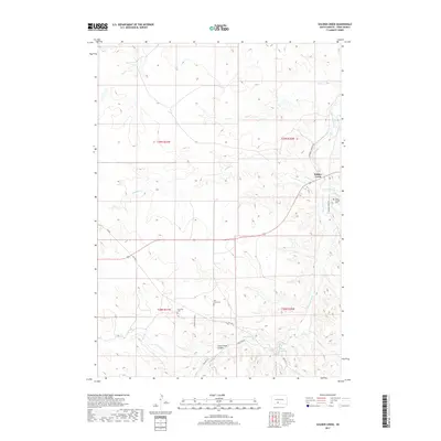
2017 Map of Soldier Creek
USGS Topo · Published 2017About this map
Soldier Creek serves as a primary settlement within this section of the Rosebud Indian Reservation, situated where the Little White River and Scabby Cr meet. The landscape is defined by the drainage patterns of these waterways and Rosebud Cr, cutting through the plains of Todd County. Genealogy and local history researchers will find several small burial grounds across the territory, including Salt Camp Cem, Ironwood Cem, and Grace Chapel Cem near the river. Cultural landmarks and family-named routes such as Old Bing Thunder Rd and Buffalo Head Dr highlight the enduring local connections to the land. Significant natural features like Crazy Horse Canyon and Ghost Hawk Lake illustrate the area's geography, while markers like Grass Mount provide specific points of reference for navigating the terrain south of the Soldier Creek community.
Find a feature on this map
22 named features on this map. Tap any name to fly to it.
Don’t see what you’re looking for? This feature index may not catch every label — zoom into the map to look around manually.
Map Details
Editions of this 2017 Soldier Creek Map
This is the sole edition of this map. No revisions or reprints were ever made.
Other maps of this area

1955 · Martin
USGS Topo · 1:250,000

1958 · Martin
USGS Topo · 1:250,000

1969 · Soldier Creek NE
USGS Topo · 1:24,000

1969 · Parmelee NE
USGS Topo · 1:24,000

1969 · Soldier Creek
USGS Topo · 1:24,000

1969 · Parmelee
USGS Topo · 1:24,000

1969 · Soldier Creek NW
USGS Topo · 1:24,000

1969 · Iron Shell Flat East
USGS Topo · 1:24,000

1969 · Soldier Creek SE
USGS Topo · 1:24,000

1969 · Rosebud
USGS Topo · 1:24,000
Featured Places
- Rosebud, SD
- Grass Mountain Segment, SD
- Soldier Creek, Soldier Creek Segment
- Parmelee, SD
- Ring Thunder Segment, SD