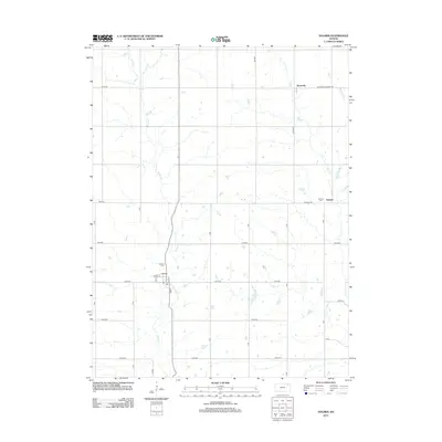
2012 Map of Soldier
USGS Topo · Published 2012About this map
Soldier occupies the southwestern quadrant of this Jackson County survey, organized around a traditional grid of streets including Logan St and Friend St. The town serves as a local hub for the surrounding agricultural prairie, situated along the banks of Soldier Cr. To the north and east, the small communities of Bancroft and Ontario appear as quiet rural clusters, with the Ontario Cem and Soldier Cem providing significant points of interest for genealogists tracing early Kansas families. The landscape is defined by the drainage patterns of Elk Cr and Mosquito Cr, which cut through a strictly rectilinear road network of named routes like Wetmore-Bancroft Rd and Parallel Rd. This layout illustrates the persistent influence of the Public Land Survey System on the modern Kansas countryside.
Find a feature on this map
32 named features on this map. Tap any name to fly to it.
Don’t see what you’re looking for? This feature index may not catch every label — zoom into the map to look around manually.
Map Details
Editions of this 2012 Soldier Map
This is the sole edition of this map. No revisions or reprints were ever made.
Other maps of this area

1888 · Hiawatha
USGS Topo · 1:125,000

1889 · Seneca
USGS Topo · 1:125,000

1889 · Wamego
USGS Topo · 1:125,000

1889 · Topeka
USGS Topo · 1:125,000

1894 · Seneca
USGS Topo · 1:125,000

1894 · Topeka
USGS Topo · 1:125,000

1894 · Hiawatha
USGS Topo · 1:125,000

1894 · Wamego
USGS Topo · 1:125,000

1950 · Kansas City
USGS Topo · 1:250,000

1954 · Kansas City
USGS Topo · 1:250,000