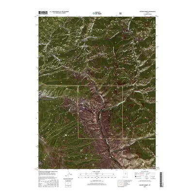
2017 Map of Soldier Summit
USGS Topo · Published 2017About this map
Soldier Summit sits at the high point of this mountain pass, marking a significant transition between Utah and Wasatch counties. This high-altitude landscape is defined by the headwaters of the White River, which is fed by numerous tributaries including the Left Fork White River, Middle Fork White River, and Right Fork White River. The terrain is characterized by a series of prominent ridges such as Aagard Ridge and Road Ridge, alongside deep drainage systems like Tabbyune Canyon and Trail Canyon. The Uinta National Forest encompasses a large portion of this mountainous area, where land surveyors recorded a network of canyons including Boiler Canyon and Averett Canyon. Genealogists may find particular interest in the Soldier Summit Cem, located just south of the main settlement near Soldier Cr.
Find a feature on this map
30 named features on this map. Tap any name to fly to it.
Don’t see what you’re looking for? This feature index may not catch every label — zoom into the map to look around manually.
Map Details
Editions of this 2017 Soldier Summit Map
This is the sole edition of this map. No revisions or reprints were ever made.
Other maps of this area

1885 · Salt Lake
USGS Topo · 1:250,000

1885 · Manti
USGS Topo · 1:250,000

1885 · Uinta
USGS Topo · 1:250,000

1886 · Price River
USGS Topo · 1:250,000

1895 · Manti
USGS Topo · 1:250,000

1896 · Price River
USGS Topo · 1:250,000

1907 · Strawberry Valley
USGS Topo · 1:125,000

1909 · Strawberry Valley
USGS Topo · 1:125,000

1939 · Soldier Summit
USGS Topo · 1:62,500

1942 · Soldier Summit
USGS Topo · 1:62,500