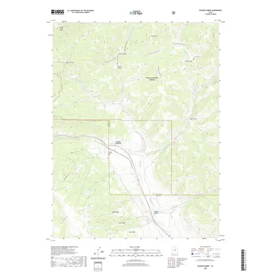
2020 Map of Soldier Summit
USGS Topo · Published 2020About this map
Soldier Summit sits at the hydrological and logistical divide where the Great Basin meets the Colorado River drainage system. This high-altitude pass, long a critical mountain crossing, is depicted here in detail, showing the small settlement and the Soldier Summit Cem positioned near the summit. The landscape is defined by the headwaters of the White River, which branches into the Left Fork White River, Middle Fork White River, and Right Fork White River. These watercourses have carved deep canyons like Averett Canyon and Boiler Canyon through the Wasatch Plateau. Much of the northeast quadrant lies within the Uinta National Forest, where steep terrain is marked by prominent landforms such as Aagard Ridge and Willow Creek Ridge. The map also captures the administrative transition at the Utah and Wasatch County line, tracing how modern roadways like Alta Dr and Elk Meadow Dr navigate the complex topography.
Find a feature on this map
26 named features on this map. Tap any name to fly to it.
Don’t see what you’re looking for? This feature index may not catch every label — zoom into the map to look around manually.
Map Details
Editions of this 2020 Soldier Summit Map
This is the sole edition of this map. No revisions or reprints were ever made.
Other maps of this area

1885 · Salt Lake
USGS Topo · 1:250,000

1885 · Manti
USGS Topo · 1:250,000

1885 · Uinta
USGS Topo · 1:250,000

1886 · Price River
USGS Topo · 1:250,000

1895 · Manti
USGS Topo · 1:250,000

1896 · Price River
USGS Topo · 1:250,000

1907 · Strawberry Valley
USGS Topo · 1:125,000

1909 · Strawberry Valley
USGS Topo · 1:125,000

1939 · Soldier Summit
USGS Topo · 1:62,500

1942 · Soldier Summit
USGS Topo · 1:62,500