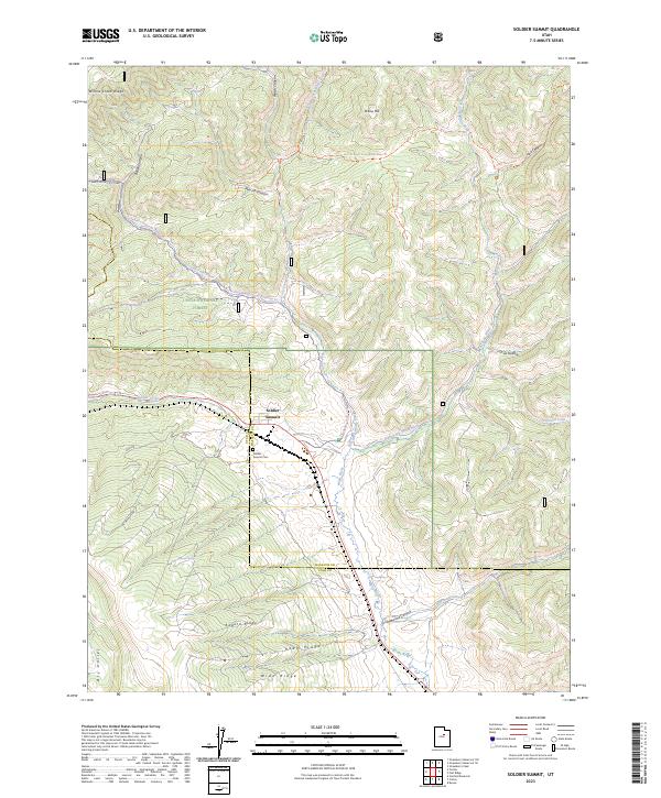
2023 Map of Soldier Summit
USGS Topo · Published 2023About this map
Soldier Summit sits at the high point of this mountain pass, marking a significant transition between the Wasatch and Utah County lines. The settlement is anchored by the Soldier Summit Cem, reflecting the area's long-standing role as a vital corridor through the mountains. Much of the surrounding high country is protected within the Uinta National Forest, where a network of water sources like Hunter Spring and the converging forks of the White River define the local geography. The landscape is characterized by a series of prominent high-elevation features, including Willow Creek Ridge and Aagard Ridge, which separate the various drainage basins. Modern trails such as the Strawberry-Snoma Groomed Trl provide access across this terrain, following the natural paths carved by Soldier Creek and Tabbyune Creek through the canyons.
Find a feature on this map
32 named features on this map. Tap any name to fly to it.
Don’t see what you’re looking for? This feature index may not catch every label — zoom into the map to look around manually.
Map Details
Editions of this 2023 Soldier Summit Map
This is the sole edition of this map. No revisions or reprints were ever made.
Other maps of this area

1885 · Salt Lake
USGS Topo · 1:250,000

1885 · Manti
USGS Topo · 1:250,000

1885 · Uinta
USGS Topo · 1:250,000

1886 · Price River
USGS Topo · 1:250,000

1895 · Manti
USGS Topo · 1:250,000

1896 · Price River
USGS Topo · 1:250,000

1907 · Strawberry Valley
USGS Topo · 1:125,000

1909 · Strawberry Valley
USGS Topo · 1:125,000

1939 · Soldier Summit
USGS Topo · 1:62,500

1942 · Soldier Summit
USGS Topo · 1:62,500