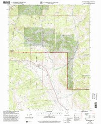
1998 Map of Soldier Summit
USGS Topo · Published 2002About this map
Soldier Summit sits at a critical high point where mountain drainage systems diverge, marking a vital transition between the high desert and mountain passes during the late twentieth century. The landscape is defined by the heavy presence of the Uinta National Forest and the Uintah and Ouray Ind Res Bdy, which govern the development of the rugged terrain. Transportation and water management are central to this area, evidenced by the network of trails and 4WD roads that navigate the complex ridges, including Wagard Ridge and Wide Ridge. Numerous water sources such as Soldier Creek, Hunter Spring, and the White River dictate the historical positioning of settlements like Tucker. The inclusion of several Prospect sites and the Spanish Fork Ranger District infrastructure highlights the dual legacy of resource extraction and federal land management in the Wasatch region.
Find a feature on this map
33 named features on this map. Tap any name to fly to it.
Don’t see what you’re looking for? This feature index may not catch every label — zoom into the map to look around manually.
Map Details
Editions of this 1998 Soldier Summit Map
This is the sole edition of this map. No revisions or reprints were ever made.
Other maps of this area

1885 · Salt Lake
USGS Topo · 1:250,000

1885 · Manti
USGS Topo · 1:250,000

1885 · Uinta
USGS Topo · 1:250,000

1886 · Price River
USGS Topo · 1:250,000

1895 · Manti
USGS Topo · 1:250,000

1896 · Price River
USGS Topo · 1:250,000

1907 · Strawberry Valley
USGS Topo · 1:125,000

1909 · Strawberry Valley
USGS Topo · 1:125,000

1939 · Soldier Summit
USGS Topo · 1:62,500

1942 · Soldier Summit
USGS Topo · 1:62,500