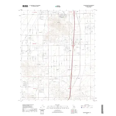
2018 Map of Soledad Mountain
USGS Topo · Published 2018About this map
Soledad Mtn dominates the center of this terrain, marking the high ground of the western Mojave Desert in Kern County. The map details a landscape defined by significant elevation changes, where several distinct peaks like Gem Hill, Fiss Hill, and Tropico Hill rise above the surrounding flats. To the north, a dense grid of residential streets including Silver Queen Rd and El Dorado Ave clusters around the northern slopes, signaling local development patterns at the edge of the desert.
Find a feature on this map
70 named features on this map. Tap any name to fly to it.
Don’t see what you’re looking for? This feature index may not catch every label — zoom into the map to look around manually.
Map Details
Editions of this 2018 Soledad Mountain Map
This is the sole edition of this map. No revisions or reprints were ever made.
Other maps of this area

1915 · Elizabeth Lake
USGS Topo · 1:125,000

1915 · Mojave
USGS Topo · 1:125,000

1917 · Elizabeth Lake
USGS Topo · 1:125,000

1943 · Rosamond
USGS Topo · 1:62,500

1943 · Tehachapi
USGS Topo · 1:62,500

1943 · Mojave
USGS Topo · 1:62,500

1943 · Willow Springs
USGS Topo · 1:62,500
1947 · Rosamond
USGS Topo · 1:24,000

1947 · Plano
USGS Topo · 1:24,000

1947 · Mojave
USGS Topo · 1:24,000