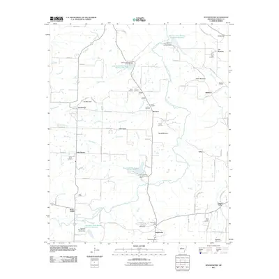
2011 Map of Solgohachia
USGS Topo · Published 2011About this map
Solgohachia Post Office serves as a central landmark in this part of Conway County, situated near the base of Jenkins Mountain. The landscape is defined by a series of engineered water controls along the East Fork Point Remove Creek, including several numbered reservoirs and dams such as the East Fork Point Remove Site Ten Reservoir. These water management features are interspersed with small communities like Lanty, Wonderview, and Saint Vincent. The map is particularly rich for genealogical research, documenting numerous family and community burial grounds including Saint Marys Cemetery, Fonville Cemetery, and Adams Cemetery. Elevations rise toward the north and east at Lick Mountain and Dutton Mountain, while the southern reaches near Solgohachia transition into the drainages of Cooks Branch.
Find a feature on this map
91 named features on this map. Tap any name to fly to it.
Don’t see what you’re looking for? This feature index may not catch every label — zoom into the map to look around manually.
Map Details
Editions of this 2011 Solgohachia Map
This is the sole edition of this map. No revisions or reprints were ever made.
Other maps of this area

1889 · Morrilton No. 3
USGS Topo · 1:62,500

1892 · Morrillton
USGS Topo · 1:125,000

1894 · Morrillton
USGS Topo · 1:125,000

1956 · Russellville
USGS Topo · 1:250,000

1961 · Menifee
USGS Topo · 1:24,000

1961 · Morrilton East
USGS Topo · 1:24,000

1961 · Morrilton West
USGS Topo · 1:24,000
1962 · Jerusalem
USGS Topo · 1:24,000
1962 · Cleveland
USGS Topo · 1:24,000
1962 · Solgohachia
USGS Topo · 1:24,000