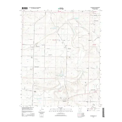
2014 Map of Solgohachia
USGS Topo · Published 2014About this map
Solgohachia and the surrounding Arkansas hills show a landscape defined by several small hamlets and the management of East Fork Point Remove Creek. The 2014 terrain is punctuated by significant water control features, including the E Fork Point Remove Site Eight Reservoir and similar numbered sites, which have shaped the local hydrology. Genealogy and local history researchers will find a high concentration of cemeteries such as Saint Marys Cem and Lanty Cem, along with the Wesley Chapel and its associated settlement. The presence of Missile Rd near Pigeon Roost Mtn hints at the area's modern infrastructure needs amidst traditional rural settings like Lanty and Wonderview. This map provides a clear picture of how family and community landmarks persist alongside state-managed water systems.
Find a feature on this map
117 named features on this map. Tap any name to fly to it.
Don’t see what you’re looking for? This feature index may not catch every label — zoom into the map to look around manually.
Map Details
Editions of this 2014 Solgohachia Map
This is the sole edition of this map. No revisions or reprints were ever made.
Other maps of this area

1889 · Morrilton No. 3
USGS Topo · 1:62,500

1892 · Morrillton
USGS Topo · 1:125,000

1894 · Morrillton
USGS Topo · 1:125,000

1956 · Russellville
USGS Topo · 1:250,000

1961 · Menifee
USGS Topo · 1:24,000

1961 · Morrilton East
USGS Topo · 1:24,000

1961 · Morrilton West
USGS Topo · 1:24,000
1962 · Jerusalem
USGS Topo · 1:24,000
1962 · Cleveland
USGS Topo · 1:24,000
1962 · Solgohachia
USGS Topo · 1:24,000