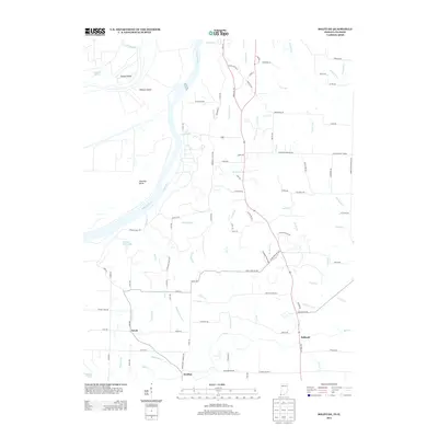
2013 Map of Solitude
USGS Topo · Published 2013About this map
Harmonie State Park dominates the central landscape of this Posey County region, where the Wabash River carves a complex boundary between Indiana and Illinois. The river's path is marked by significant landforms such as Turkey Island, Ribeyre Island, and the sharp curve of Bowman Bend. Small residential clusters at Solitude, Savah, and Grafton represent the localized settlement pattern, connected by a network of rural routes like Old Plank Rd N and Maple Hill Rd. The terrain is deeply etched by a dense hydrographic system, including Pahoka Camp Lake and numerous drainage runs such as Swift Run, Duo Run, and Tri Brook. This map captures the agricultural and conservation-focused character of the Wabash valley, where narrow tributaries like Maple Run and Thorn Run drain into the broad river basin.
Find a feature on this map
111 named features on this map. Tap any name to fly to it.
Don’t see what you’re looking for? This feature index may not catch every label — zoom into the map to look around manually.
Map Details
Editions of this 2013 Solitude Map
This is the sole edition of this map. No revisions or reprints were ever made.
Other maps of this area

1903 · New Harmony
USGS Topo · 1:62,500

1903 · Patoka
USGS Topo · 1:125,000

1905 · New Haven
USGS Topo · 1:62,500

1906 · New Haven
USGS Topo · 1:62,500

1917 · Uniontown
USGS Topo · 1:62,500

1938 · New Harmony
USGS Topo · 1:62,500

1940 · Carmi
USGS Topo · 1:62,500

1943 · Carmi
USGS Topo · 1:62,500

1949 · Paducah
USGS Topo · 1:250,000

1949 · New Haven
USGS Topo · 1:62,500