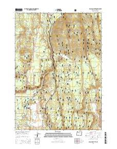
2014 Map of Soloman Butte
USGS Topo · Published 2014About this map
The Williamson River snakes through the high country of the Winema National Forest in this 2014 survey, defining a landscape shaped by volcanic geography and early 20th-century industry. The settlement of Kirk serves as a primary point of reference, situated near the river's northern bend. This area was once a significant railhead and milling center, a history reflected in labels like the Kirk-Broy Mill Rd and various forest development roads.
Find a feature on this map
38 named features on this map. Tap any name to fly to it.
Don’t see what you’re looking for? This feature index may not catch every label — zoom into the map to look around manually.
Map Details
Editions of this 2014 Soloman Butte Map
This is the sole edition of this map. No revisions or reprints were ever made.
Other maps of this area

1889 · Klamath
USGS Topo · 1:250,000

1894 · Klamath
USGS Topo · 1:250,000

1955 · Klamath Falls
USGS Topo · 1:250,000

1956 · Calimus Butte
USGS Topo · 1:62,500

1957 · Chiloquin
USGS Topo · 1:62,500

1957 · Klamath Marsh
USGS Topo · 1:62,500

1957 · Lenz
USGS Topo · 1:62,500

1958 · Klamath Falls
USGS Topo · 1:250,000

1980 · Williamson River
USGS Topo · 1:100,000
1985 · Agency Lake
USGS Topo · 1:24,000