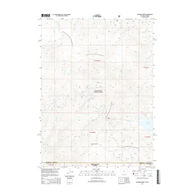
2015 Map of Solomon Creek
USGS Topo · Published 2015About this map
Sierra Madre and the high ridges of the Continental Divide define this wilderness corridor along the border of Colorado and Wyoming. This 2015 survey documents a rugged landscape where the headwaters of several major drainages begin their descent, including the N Fork Encampment River flowing north and the N Fork Little Snake River trending south. The map highlights the transition between the Medicine Bow National Forest and the Routt National Forest, a region primarily defined by its hydrology and high-altitude topography rather than permanent settlement. The Continental Divide National Scenic Trail- Wyoming Portion snakes through the northern half of the quadrangle, passing beneath Green Mtn. In the southeast, Hog Park Reservoir serves as a significant water feature, fed by Hog Park Cr.
Find a feature on this map
28 named features on this map. Tap any name to fly to it.
Don’t see what you’re looking for? This feature index may not catch every label — zoom into the map to look around manually.
Map Details
Editions of this 2015 Solomon Creek Map
This is the sole edition of this map. No revisions or reprints were ever made.
Other maps of this area

1911 · Hahns Peak
USGS Topo · 1:125,000

1913 · Hahns Peak
USGS Topo · 1:125,000

1932 · Savery
USGS Topo · 1:96,000

1939 · Saratoga
USGS Topo · 1:125,000

1940 · Savery
USGS Topo · 1:125,000

1954 · Rawlins
USGS Topo · 1:250,000

1954 · Craig
USGS Topo · 1:250,000

1957 · Craig
USGS Topo · 1:250,000

1958 · Rawlins
USGS Topo · 1:250,000

1958 · Craig
USGS Topo · 1:250,000