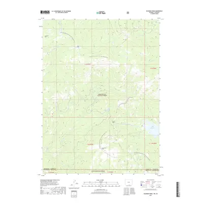
2017 Map of Solomon Creek
USGS Topo · Published 2017About this map
The Continental Divide crests through this high-country landscape, serving as the topographical spine where the Medicine Bow National Forest in Wyoming meets the Routt National Forest in Colorado. The region is defined by its complex drainage systems, with the N Fork Little Snake River and Solomon Creek carving through the steep terrain of the Sierra Madre range. High-altitude meadows such as Huston Park and Standard Park offer a contrast to the dense timberland, while the Continental Divide National Scenic Trail winds along the heights, tracking the literal boundary of the American West. In the southeast corner, the Hog Park Reservoir sits as a significant water feature, fed by Hog Park Creek and Whiskey Creek. This survey captures a remote wilderness area where natural hydrology and federal forest boundaries dictate the movement of travelers and water alike.
Find a feature on this map
29 named features on this map. Tap any name to fly to it.
Don’t see what you’re looking for? This feature index may not catch every label — zoom into the map to look around manually.
Map Details
Editions of this 2017 Solomon Creek Map
This is the sole edition of this map. No revisions or reprints were ever made.
Other maps of this area

1911 · Hahns Peak
USGS Topo · 1:125,000

1913 · Hahns Peak
USGS Topo · 1:125,000

1932 · Savery
USGS Topo · 1:96,000

1939 · Saratoga
USGS Topo · 1:125,000

1940 · Savery
USGS Topo · 1:125,000

1954 · Rawlins
USGS Topo · 1:250,000

1954 · Craig
USGS Topo · 1:250,000

1957 · Craig
USGS Topo · 1:250,000

1958 · Rawlins
USGS Topo · 1:250,000

1958 · Craig
USGS Topo · 1:250,000