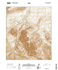
2017 Map of Solomon D-6 NE
USGS Topo · Published 2017About this map
Iron Creek is the primary namesake settlement in this northern reach of the Seward Peninsula, situated where mining prospects once drew prospectors to the interior. The landscape is defined by an intricate network of waterways draining the high ground, including Gold Cr, Homestake Cr, and Discovery Cr, names that speak to the region's mineral history. These streams feed into the larger Pilgrim River and W Br Sherrette Cr. Access to this remote environment is provided by the Kougarok Road/Nome-Taylor Highway, which cuts across the northwestern corner of the quadrangle. The topography is characterized by steep drainage basins, with features like American Cr and Breen Cr carving deep valleys into the terrain, reflecting the isolation and challenging geography of the Nome Census Area during the early twenty-first century.
Find a feature on this map
23 named features on this map. Tap any name to fly to it.
Don’t see what you’re looking for? This feature index may not catch every label — zoom into the map to look around manually.
Map Details
Editions of this 2017 Solomon D-6 NE Map
This is the sole edition of this map. No revisions or reprints were ever made.
Other maps of this area

1907 · Casadepaga
USGS Topo · 1:62,500

1950 · Bendeleben A-6
USGS Topo · 1:63,360

1950 · Bendeleben A-5
USGS Topo · 1:63,360

1950 · Bendeleben
USGS Topo · 1:250,000

1950 · Solomon
USGS Topo · 1:250,000

1950 · Solomon D-6
USGS Topo · 1:63,360

1950 · Solomon D-5
USGS Topo · 1:63,360

1951 · Bendeleben
USGS Topo · 1:250,000

1951 · Solomon
USGS Topo · 1:250,000

1964 · Bendeleben
USGS Topo · 1:250,000