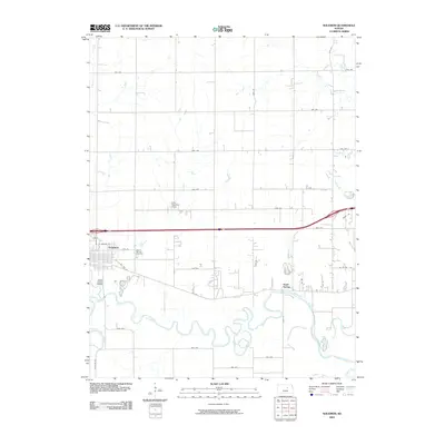
2009 Map of Solomon
USGS Topo · Published 2009About this map
The Smoky Hill River winds in tight, serpentine loops across this Dickinson County landscape, defining the southern geography of the region. This 2009 survey highlights the town of Solomon, where the street grid meets the historic alignment of Old Hwy 40. This road, along with the newer interstate corridor, parallels the ancient river valley, illustrating a long-standing transportation corridor across the Kansas prairie.
Find a feature on this map
32 named features on this map. Tap any name to fly to it.
Don’t see what you’re looking for? This feature index may not catch every label — zoom into the map to look around manually.
Map Details
Editions of this 2009 Solomon Map
This is the sole edition of this map. No revisions or reprints were ever made.
Other maps of this area

1889 · Abilene
USGS Topo · 1:125,000

1891 · Clay Center
USGS Topo · 1:125,000

1894 · Abilene
USGS Topo · 1:125,000

1955 · Niles
USGS Topo · 1:24,000

1955 · Kipp
USGS Topo · 1:24,000

1955 · Manhattan
USGS Topo · 1:250,000

1955 · Hutchinson
USGS Topo · 1:250,000

1956 · Manhattan
USGS Topo · 1:250,000

1957 · Manhattan
USGS Topo · 1:250,000

1959 · Hutchinson
USGS Topo · 1:250,000