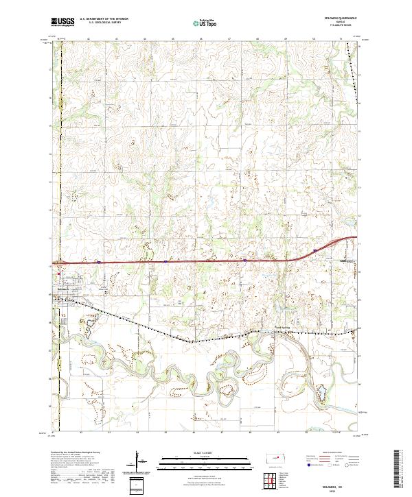
2022 Map of Solomon
USGS Topo · Published 2022About this map
Solomon sits at the confluence where the Solomon River meets the Smoky Hill River, a landscape defined by the winding hydrology of the Kansas plains. This modern topographic record shows the dense grid of county roads, including 2700 Ave and 2000 Ave, that partition the agricultural land between the larger hubs of Solomon and the western outskirts of Abilene. The terrain is marked by significant oxbows and river bends, particularly along the Smoky Hill River south of Sand Spring.
Find a feature on this map
61 named features on this map. Tap any name to fly to it.
Don’t see what you’re looking for? This feature index may not catch every label — zoom into the map to look around manually.
Map Details
Editions of this 2022 Solomon Map
This is the sole edition of this map. No revisions or reprints were ever made.
Other maps of this area

1889 · Abilene
USGS Topo · 1:125,000

1891 · Clay Center
USGS Topo · 1:125,000

1894 · Abilene
USGS Topo · 1:125,000

1955 · Niles
USGS Topo · 1:24,000

1955 · Kipp
USGS Topo · 1:24,000

1955 · Manhattan
USGS Topo · 1:250,000

1955 · Hutchinson
USGS Topo · 1:250,000

1956 · Manhattan
USGS Topo · 1:250,000

1957 · Manhattan
USGS Topo · 1:250,000

1959 · Hutchinson
USGS Topo · 1:250,000