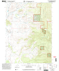
2001 Map of Solomons Temple
USGS Topo · Published 2004About this map
Shasta Valley transitions into the high timberlands of the Klamath National Forest in this 2001 revision of Siskiyou County terrain. The landscape is defined by the hydrologic necessity of the arid west, evidenced by the high density of wells such as Well 847 and Well 915 clustered near the rural settlements of Williams Martin and Kegg. The eastern half of the map rises sharply toward the distinctive geologic formation of Solomons Temple and Temple Rock, overlooking the winding path of the Little Shasta River. Ranching and small-scale habitation markers like the Landing Strip and named road networks, including Hart Road and Davis Road, trace the footprint of local families across the valley floor. The map captures a specific interface between managed forest lands and the agricultural heritage of the high desert basin.
Find a feature on this map
53 named features on this map. Tap any name to fly to it.
Don’t see what you’re looking for? This feature index may not catch every label — zoom into the map to look around manually.
Map Details
Editions of this 2001 Solomons Temple Map
This is the sole edition of this map. No revisions or reprints were ever made.
Other maps of this area

1886 · Shasta
USGS Topo · 1:250,000

1894 · Shasta
USGS Topo · 1:250,000

1921 · Shasta Valley Sheet No 11
USGS Topo · 1:24,000

1922 · Shasta Valley Sheet No 10 E
USGS Topo · 1:24,000

1922 · Shasta Valley Sheet No 12
USGS Topo · 1:24,000

1934 · Macdoel
USGS Topo · 1:96,000

1941 · Macdoel
USGS Topo · 1:125,000

1948 · Weed
USGS Topo · 1:250,000

1950 · Weed
USGS Topo · 1:250,000

1954 · The Whaleback
USGS Topo · 1:62,500