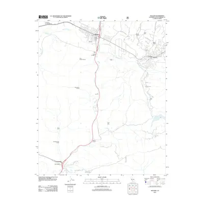
2012 Map of Solvang
USGS Topo · Published 2012About this map
Solvang and Buellton anchor this 2012 study of the Santa Ynez Valley, revealing a landscape defined by the Santa Ynez River and the legacy of ranching and viticulture. The map illustrates the region's agricultural and tourism roots through features like Mosby Winery, Copenhagen Cellars, and Alisal Ranch. The southern portion transitions into the steep terrain of the Santa Ynez Mountains, where the historic crossroads at Las Cruces sits near Gaviota State Park. Topographic details reveal numerous canyons and peaks, including Gaviota Peak and Adobe Canyon, alongside local landmarks such as Nojoqui Falls. This survey documents the modern layout of the Danish-themed village of Solvang, including its residential expansion and local institutions like the Solvang Cem. The proximity of active ranch lands such as Gardner Ranch and Folded Hills Ranch alongside developed corridors like the Avenue of the Flags highlights the unique mix of rural heritage and visitor-oriented commerce in Santa Barbara County.
Find a feature on this map
56 named features on this map. Tap any name to fly to it.
Don’t see what you’re looking for? This feature index may not catch every label — zoom into the map to look around manually.
Map Details
Editions of this 2012 Solvang Map
This is the sole edition of this map. No revisions or reprints were ever made.
Other maps of this area

1905 · Lompoc
USGS Topo · 1:125,000

1942 · Lompoc
USGS Topo · 1:125,000

1942 · Lompoc
USGS Topo · 1:62,500

1942 · Pt. Conception
USGS Topo · 1:62,500

1942 · Gaviota
USGS Topo · 1:62,500

1942 · Los Olivos
USGS Topo · 1:62,500

1943 · Los Olivos
USGS Topo · 1:62,500

1943 · Lompoc
USGS Topo · 1:125,000

1943 · Gaviota
USGS Topo · 1:62,500

1947 · Gaviota
USGS Topo · 1:62,500