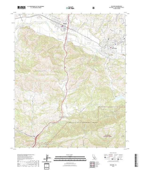
2021 Map of Solvang
USGS Topo · Published 2021About this map
Solvang and Buellton anchor the northern reaches of this coastal canyon country, where the Santa Ynez River carves through the Santa Ynez Valley. The landscape transitions from the urbanized Danish-themed blocks of Solvang to the steep elevations of the Santa Ynez Mountains and the Purisima Hills. This terrain is defined by a dense network of canyons, including Ballard Canyon, Adobe Canyon, and Moonshine Canyon, which funnel drainage into the valley floor. To the south, the map documents the higher peaks of the Los Padres National Forest, reaching a high point at Gaviota Peak. Significant water features and local landmarks such as Nojoqui Falls and the Hot Springs near Las Canovas Cr indicate the geothermal and hydrologic activity characteristic of the California Coast Ranges. The layout of the Old Coast Hwy and the passage over Nojoqui Summit illustrate the primary transportation corridor connecting the Santa Ynez Valley to the Pacific coast.
Find a feature on this map
50 named features on this map. Tap any name to fly to it.
Don’t see what you’re looking for? This feature index may not catch every label — zoom into the map to look around manually.
Map Details
Editions of this 2021 Solvang Map
This is the sole edition of this map. No revisions or reprints were ever made.
Other maps of this area

1905 · Lompoc
USGS Topo · 1:125,000

1942 · Lompoc
USGS Topo · 1:125,000

1942 · Lompoc
USGS Topo · 1:62,500

1942 · Pt. Conception
USGS Topo · 1:62,500

1942 · Gaviota
USGS Topo · 1:62,500

1942 · Los Olivos
USGS Topo · 1:62,500

1943 · Los Olivos
USGS Topo · 1:62,500

1943 · Lompoc
USGS Topo · 1:125,000

1943 · Gaviota
USGS Topo · 1:62,500

1947 · Gaviota
USGS Topo · 1:62,500