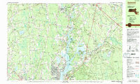
1985 Map of Somerset
USGS Topo · Published 1985About this map
The Taunton River serves as the central artery for this mid-1980s landscape, winding south toward Fall River through a region defined by its tidal marshes and growing suburban infrastructure. This period shows the established residential patterns of Somerset and Pottersville, contrasted with the larger wooded tracts of the Freetown State Forest and Berkley State Forest. Local history is anchored by the Old Town Landing and the famous petroglyphs near Dighton Rock State Park, which highlight the area's long-standing connection to the riverfront.
Find a feature on this map
100 named features on this map. Tap any name to fly to it.
Don’t see what you’re looking for? This feature index may not catch every label — zoom into the map to look around manually.
Map Details
Editions of this 1985 Somerset Map
2 editions found
Other maps of this area

1885 · New Bedford
USGS Topo · 1:62,500

1885 · Middleboro
USGS Topo · 1:62,500

1885 · Taunton
USGS Topo · 1:62,500

1887 · Providence
USGS Topo · 1:62,500

1888 · New Bedford
USGS Topo · 1:62,500

1888 · Fall River
USGS Topo · 1:62,500

1888 · Taunton
USGS Topo · 1:62,500

1888 · Middleboro
USGS Topo · 1:62,500

1889 · Providence
USGS Topo · 1:62,500

1890 · Narragansett Bay
USGS Topo · 1:62,500