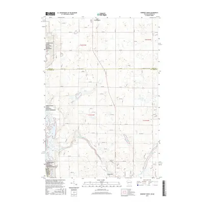
2015 Map of Somerset North
USGS Topo · Published 2015About this map
The Apple River meanders through this landscape, creating a distinct hydrographic pattern that includes the Apple Falls Flowage 559 and the Riverdale Flowage. These water features, alongside Apple River Falls, highlight the importance of the river system to the development of Somerset and its surroundings. The Western boundary is defined by the Lower Saint Croix National Scenic Riverway, marking the border between Wisconsin and Minnesota.
Find a feature on this map
55 named features on this map. Tap any name to fly to it.
Don’t see what you’re looking for? This feature index may not catch every label — zoom into the map to look around manually.
Map Details
Editions of this 2015 Somerset North Map
This is the sole edition of this map. No revisions or reprints were ever made.
Other maps of this area

1900 · St Croix Dalles
USGS Topo · 1:62,500

1901 · St Croix Dalles
USGS Topo · 1:62,500

1948 · New Richmond
USGS Topo · 1:62,500

1948 · Stillwater
USGS Topo · 1:62,500

1949 · New Richmond
USGS Topo · 1:62,500

1949 · Stillwater
USGS Topo · 1:62,500

1951 · Stillwater
USGS Topo · 1:24,000

1953 · Stillwater
USGS Topo · 1:250,000

1955 · St. Croix Dalles
USGS Topo · 1:62,500

1955 · Marine
USGS Topo · 1:24,000