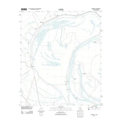
2012 Map of Somerset
USGS Topo · Published 2012About this map
Hapaca Plantation and the rural settlement of Somerset define this riverine landscape along the Mississippi-Louisiana border. The terrain is a complex network of oxbow lakes and historical watercourses, including Palmyra Lake and Duck Lake, which wrap around Hurricane Island and Middle Palmyra Island. These geological features trace the shifting path of the river, creating a landscape of points and bends like Palmyra Bend. Local history is anchored by several small burial grounds, such as Saint John Cem and Somerset Cem, located near the agricultural roads of Bear Den Rd and Turn Row. Further north, the settlements of Quimby and Afton sit near Mud Lake, while river access points like Somerset Landing and Ashwood Landing indicate the importance of the waterfront to this isolated community.
Find a feature on this map
32 named features on this map. Tap any name to fly to it.
Don’t see what you’re looking for? This feature index may not catch every label — zoom into the map to look around manually.
Map Details
Editions of this 2012 Somerset Map
This is the sole edition of this map. No revisions or reprints were ever made.
Other maps of this area

1909 · Mound
USGS Topo · 1:24,000

1910 · Mound
USGS Topo · 1:31,680

1935 · Waverly
USGS Topo · 1:62,500

1935 · Shackleford Lake
USGS Topo · 1:62,500

1939 · Talla Bena
USGS Topo · 1:62,500

1955 · Jackson
USGS Topo · 1:250,000

1958 · Shackleford Lake
USGS Topo · 1:62,500

1961 · Jackson
USGS Topo · 1:250,000

1961 · Waverly
USGS Topo · 1:62,500

1962 · Jackson
USGS Topo · 1:250,000